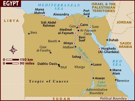
There are three main boundaries to Egypt. To the south is Egypt's border with Sudan; to the west, Libya; and to the east, Israel and the Gaza Strip.

The boundary with Libya, to the west, is 1,150 km long (714.1 miles) and is mostly occupied by the Libyan desert. Few people live in this region.
To the east, on the Sinai Peninsular, lies the border with Israel and the Palestinian territory of the Gaza Strip. The Israel border is 255km in length (158.8 miles), the Gaza strip boundary around 12km (7.8 miles).
Egypt also has approximately 2,900km ( 1,800 miles) of coastline, along the Mediterranean Sea, the Red Sea, the Gulf of Suez and the Gulf of Aqaba. The intricate nature of the Nile Delta makes accurate measurements of the coastline difficult.
Learn more about Egypt's geography with this short film: